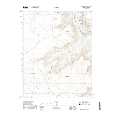
2018 Map of Quartermaster Canyon
USGS Topo · Published 2018About this map
Grand Canyon National Park meets the eastern boundary of the Lake Mead National Recreation Area in this 2018 study of northwestern Arizona. The landscape is defined by the Colorado River as it carves through the Lower Granite Gorge, featuring significant navigational hazards such as Wards Cove Rapids and Waterfall Rapids. This area is characterized by a network of deep drainages including Quartermaster Canyon and Jeff Canyon, which drop toward the river from the high plateau.
Find a feature on this map
29 named features on this map. Tap any name to fly to it.
Don’t see what you’re looking for? This feature index may not catch every label — zoom into the map to look around manually.
Map Details
Editions of this 2018 Quartermaster Canyon Map
This is the sole edition of this map. No revisions or reprints were ever made.
Other maps of this area

1886 · Diamond Creek
USGS Topo · 1:250,000

1886 · Mt. Trumbull
USGS Topo · 1:250,000

1892 · Diamond Creek
USGS Topo · 1:250,000

1892 · Mt. Trumbull
USGS Topo · 1:250,000

1948 · Williams
USGS Topo · 1:250,000

1953 · Grand Canyon
USGS Topo · 1:250,000

1954 · Williams
USGS Topo · 1:250,000

1956 · Williams
USGS Topo · 1:250,000

1957 · Grand Canyon
USGS Topo · 1:250,000

1958 · Grand Canyon
USGS Topo · 1:250,000