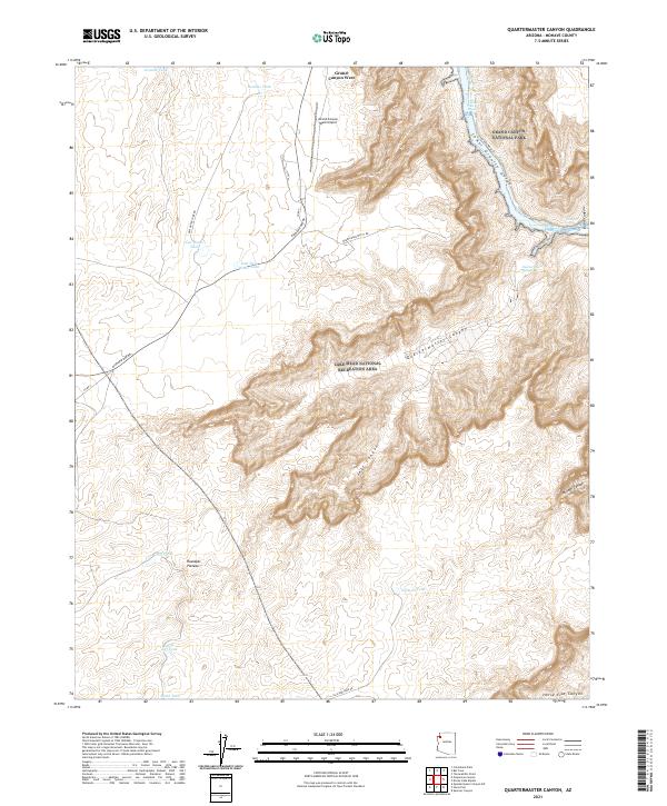
2021 Map of Quartermaster Canyon
USGS Topo · Published 2021About this map
Grand Canyon National Park and the Lake Mead National Recreation Area converge in this high-desert landscape, where the Colorado River carves through the Lower Granite Gorge. This terrain is defined by the dramatic descent from the Hualapai Plateau into deep drainages like Quartermaster Canyon and Jeff Canyon. The mapping reveals a sparse but vital network of water sources, including Quartermaster Springs and various livestock tanks such as Smith Tank, Little Jeff Tank, and Boulder Tank, which reflect the ranching and resource management history of this arid region. The arrival of modern infrastructure is evident at Grand Canyon West Airport, serving as a gateway to the spectacular geological formations nearby. Navigational landmarks like Waterfall Rapids on the river contrast with the upland roads, including Diamond Bar Rd and New Water Tank Rd, which trace the rim above the canyons.
Find a feature on this map
32 named features on this map. Tap any name to fly to it.
Don’t see what you’re looking for? This feature index may not catch every label — zoom into the map to look around manually.
Map Details
Editions of this 2021 Quartermaster Canyon Map
This is the sole edition of this map. No revisions or reprints were ever made.
Other maps of this area

1886 · Diamond Creek
USGS Topo · 1:250,000

1886 · Mt. Trumbull
USGS Topo · 1:250,000

1892 · Diamond Creek
USGS Topo · 1:250,000

1892 · Mt. Trumbull
USGS Topo · 1:250,000

1948 · Williams
USGS Topo · 1:250,000

1953 · Grand Canyon
USGS Topo · 1:250,000

1954 · Williams
USGS Topo · 1:250,000

1956 · Williams
USGS Topo · 1:250,000

1957 · Grand Canyon
USGS Topo · 1:250,000

1958 · Grand Canyon
USGS Topo · 1:250,000