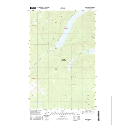
2017 Map of Quartz Ridge
USGS Topo · Published 2017About this map
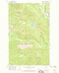
Glacier National Park dominates this landscape, defined by a dramatic sequence of alpine waters and prominent ridgelines. The western edge of the park is shaped by the parallel drainages of Akokala Creek and Bowman Creek, with the latter feeding into the expansive Bowman Lake. Further east, a chain of glacial waters including Quartz Lake, Middle Quartz Lake, and Lower Quartz Lake sits between the heights of Numa Ridge and Quartz Ridge. The Pacific NW National Scenic Trail winds through these valleys and over the passes, providing the primary access through this protected wilderness. In the south, the terrain opens into Hidden Meadow before rising toward Logging Ridge. The only vehicle access indicated is via the Bowman Lake Road, which enters from the west, highlighting the primitive and preserved nature of the backcountry near the Canadian border.
Find a feature on this map
33 named features on this map. Tap any name to fly to it.
Don’t see what you’re looking for? This feature index may not catch every label — zoom into the map to look around manually.
Map Details
Editions of this 2017 Quartz Ridge Map
This is the sole edition of this map. No revisions or reprints were ever made.
Other maps of this area

1906 · Kintla Lakes
USGS Topo · 1:125,000

1938 · Kintla Lakes
USGS Topo · 1:125,000

1957 · Kalispell
USGS Topo · 1:250,000

1960 · Kalispell
USGS Topo · 1:250,000

1961 · Kalispell
USGS Topo · 1:250,000
1966 · Camas Ridge West
USGS Topo · 1:24,000
1966 · Demers Ridge
USGS Topo · 1:24,000

1966 · Kintla Lake
USGS Topo · 1:24,000
1966 · Polebridge
USGS Topo · 1:24,000
1966 · Cyclone Lake
USGS Topo · 1:24,000