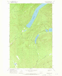
1968 Map of Quartz Ridge
USGS Topo · Published 1971About this map
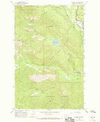
Glacier National Park presents a landscape defined by dramatic elevation changes and a complex system of glacial lakes during the late 1960s. The primary focal point is the long, narrow reach of Bowman Lake, which is served by the Bowman Lake Trail and features a Campground, Picnic Area, and a Ranger Sta. Further east, a chain of water bodies including Quartz Lake, Middle Quartz Lake, and Lower Quartz Lake are connected by Quartz Creek, illustrating the natural drainage patterns of this high-altitude environment.
Find a feature on this map
25 named features on this map. Tap any name to fly to it.
Don’t see what you’re looking for? This feature index may not catch every label — zoom into the map to look around manually.
Map Details
Editions of this 1968 Quartz Ridge Map
This is the sole edition of this map. No revisions or reprints were ever made.
Other maps of this area

1906 · Kintla Lakes
USGS Topo · 1:125,000

1938 · Kintla Lakes
USGS Topo · 1:125,000

1957 · Kalispell
USGS Topo · 1:250,000

1960 · Kalispell
USGS Topo · 1:250,000

1961 · Kalispell
USGS Topo · 1:250,000
1966 · Camas Ridge West
USGS Topo · 1:24,000
1966 · Demers Ridge
USGS Topo · 1:24,000

1966 · Kintla Lake
USGS Topo · 1:24,000
1966 · Polebridge
USGS Topo · 1:24,000
1966 · Cyclone Lake
USGS Topo · 1:24,000