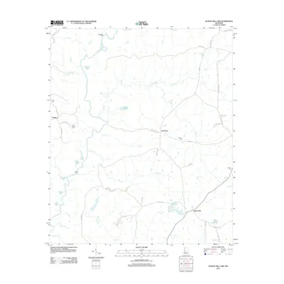
2012 Map of Queens Hill Lake
USGS Topo · Published 2012About this map
The Big Black River meanders through this portion of Hinds County, defining a landscape of wetlands and small rural settlements. This 2012 survey captures the community of Lynchburg and the historic landing at Old Marley Landing along the river's eastern banks. The terrain is dotted with numerous small lakes and bayous, including Horseshoe Lake, Gillespie Lake, and Mosal Lake, which are characteristic of the river's shifting floodplain.
Find a feature on this map
55 named features on this map. Tap any name to fly to it.
Don’t see what you’re looking for? This feature index may not catch every label — zoom into the map to look around manually.
Map Details
Editions of this 2012 Queens Hill Lake Map
This is the sole edition of this map. No revisions or reprints were ever made.
Other maps of this area

1903 · Jackson
USGS Topo · 1:125,000

1934 · Raymond
USGS Topo · 1:48,000

1937 · Raymond
USGS Topo · 1:62,500

1938 · Edwards
USGS Topo · 1:62,500

1940 · Mechanicsburg
USGS Topo · 1:62,500

1942 · Raymond
USGS Topo · 1:62,500

1955 · Jackson
USGS Topo · 1:250,000

1961 · Jackson
USGS Topo · 1:250,000

1962 · Jackson
USGS Topo · 1:250,000

1962 · Flora
USGS Topo · 1:62,500