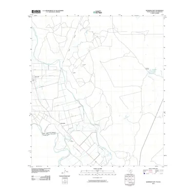
2010 Map of Quemado East
USGS Topo · Published 2010About this map
The Rio Grande serves as the international boundary on this 2010 survey of the Maverick County borderlands. The landscape is defined by the Maverick County Canal, which skirts the western edge of the settlements of Quemado and Normandy. This region of south Texas exhibits a network of rural routes such as FM 1665, Silver Bridge Rd, and Cemetery Rd, which leads toward the Valley Cemetery south of Normandy. The terrain is marked by distinctive drainages like Cañon Grande and Cañon Chiquita that feed into the valley, while the eastern portion of the map is dominated by Lowrance Lake and the Lowrance Lake Dam. The layout of the small towns reveals a grid-like settlement pattern in an otherwise arid landscape of creek beds and draws, such as Quemado Creek, highlighting the importance of managed water resources in this border territory.
Find a feature on this map
25 named features on this map. Tap any name to fly to it.
Don’t see what you’re looking for? This feature index may not catch every label — zoom into the map to look around manually.
Map Details
Editions of this 2010 Quemado East Map
This is the sole edition of this map. No revisions or reprints were ever made.
Other maps of this area

1896 · Brackett
USGS Topo · 1:125,000

1897 · Brackett
USGS Topo · 1:125,000

1940 · Paloma
USGS Topo · 1:62,500

1940 · Quemado
USGS Topo · 1:62,500

1941 · Tequesquite Creek
USGS Topo · 1:62,500

1944 · Tequesquite Creek
USGS Topo · 1:62,500

1944 · Spofford
USGS Topo · 1:62,500

1958 · Eagle Pass
USGS Topo · 1:250,000

1958 · Del Rio
USGS Topo · 1:250,000

1964 · Del Rio
USGS Topo · 1:250,000