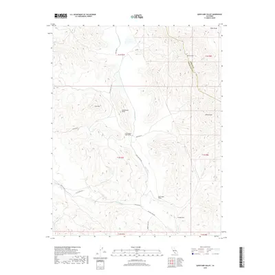
2018 Map of Quien Sabe Valley
USGS Topo · Published 2018About this map
The high ridges of the Diablo Range define this portion of the California Coast Ranges, where the boundary between Merced County and San Benito County follows the crest of the mountains near Potrero Peak. The landscape is dominated by the seasonal drainage of Quien Sabe Cr, which carves through the namesake Quien Sabe Valley and its smaller counterpart, Little Quien Sabe Valley. These basins are interconnected by ranching corridors including Quien Sabe Ranch Rd and Mc Creery Ranch Rd.
Find a feature on this map
24 named features on this map. Tap any name to fly to it.
Don’t see what you’re looking for? This feature index may not catch every label — zoom into the map to look around manually.
Map Details
Editions of this 2018 Quien Sabe Valley Map
This is the sole edition of this map. No revisions or reprints were ever made.
Other maps of this area

1919 · San Benito
USGS Topo · 1:62,500

1919 · Hollister
USGS Topo · 1:48,000

1921 · Gonzales
USGS Topo · 1:62,500

1921 · Hollister
USGS Topo · 1:62,500

1922 · Quien Sabe
USGS Topo · 1:62,500

1923 · Hollister
USGS Topo · 1:62,500

1931 · San Benito
USGS Topo · 1:62,500

1940 · Hollister
USGS Topo · 1:62,500

1940 · Quien Sabe
USGS Topo · 1:62,500

1940 · San Benito
USGS Topo · 1:62,500