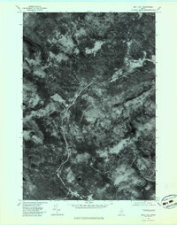
1977 Map of Quill Hill
USGS Topo · Published 1983About this map
Kennebago Settlement stands as a primary focal point in this 1977 orthophotoquad, which uses aerial imagery to document the timber-heavy landscape of western Maine. The photo-map reveals the winding path of the South Branch Dead River as it cuts through the valley floor, flanked by the prominent elevations of East Kennebago Mountain and Quill Hill. The presence of Langtown Mill and a network of logging roads illustrates the industrial character of the region during the late 1970s. Unlike standard topographic sheets, this imagery captures the actual density of the forest canopy and the precise footprints of small clearings and drainage patterns like Baker Brook, providing researchers with a literal view of the land's surface at a specific moment in time.
Find a feature on this map
6 named features on this map. Tap any name to fly to it.
Don’t see what you’re looking for? This feature index may not catch every label — zoom into the map to look around manually.
Map Details
Editions of this 1977 Quill Hill Map
This is the sole edition of this map. No revisions or reprints were ever made.
Other maps of this area

1928 · Stratton
USGS Topo · 1:48,000

1929 · Phillips
USGS Topo · 1:48,000

1932 · Phillips
USGS Topo · 1:62,500

1932 · Stratton
USGS Topo · 1:62,500

1932 · Kennebago Lake
USGS Topo · 1:48,000

1933 · Rangeley
USGS Topo · 1:48,000

1935 · Kennebago Lake
USGS Topo · 1:62,500

1936 · Kennebago Lake
USGS Topo · 1:62,500

1939 · Rangeley
USGS Topo · 1:62,500

1949 · Jackman
USGS Topo · 1:250,000
Featured Places
- Dallas Plantation, ME
- Coplin Plantation, ME
- Tim Pond Township, ME
- Redington Township, ME
- Langtown Mill, Lang Township