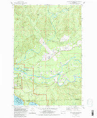
1982 Map of Quillayute Prairie
USGS Topo · Published 1982About this map
The Soleduck River and Bogachiel River converge in this coastal region of Washington, forming the Quillayute River as it flows toward the Pacific Ocean. This landscape is defined by the transition from riverine plains to the coastal wilderness of Olympic National Park. The map identifies the historical footprint of Mora (Site) near the river mouth and the inland clearing of Quillayute Prairie, which hosts the Quillayute State Airport. This area, bordered by the Quileute Indian Reservation, shows a reliance on the waterways for transport, evidenced by the Leyendecker Boat Ramp and Boat Ramp near the coast. Inland, numerous Gravel Pits suggest local extraction industries supporting the development of roads like State Highway 110 and La Push Road. The presence of the Quillayute Cem and various family-named features like James Pond and Maxfield Creek provides valuable points of reference for local family history and land use study.
Find a feature on this map
38 named features on this map. Tap any name to fly to it.
Don’t see what you’re looking for? This feature index may not catch every label — zoom into the map to look around manually.
Map Details
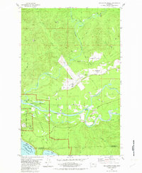
Editions of this 1982 Quillayute Prairie Map
2 editions found
Other maps of this area

1935 · Ozette Lake
USGS Topo · 1:62,500

1935 · Lake Pleasant
USGS Topo · 1:62,500

1939 · Forks
USGS Topo · 1:62,500

1942 · Ozette Lake
USGS Topo · 1:62,500

1942 · Lake Pleasant
USGS Topo · 1:62,500

1943 · Copalis Beach
USGS Topo · 1:250,000

1951 · Copalis Beach
USGS Topo · 1:250,000

1953 · Cape Flattery
USGS Topo · 1:250,000

1956 · La Push
USGS Topo · 1:62,500

1956 · Ozette Lake
USGS Topo · 1:62,500