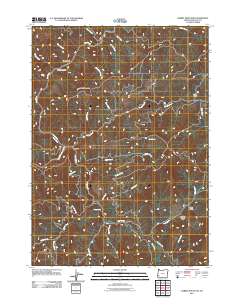
2011 Map of Rabbit Mountain
USGS Topo · Published 2011About this map
Rabbit Mountain and the winding course of Cow Creek define this landscape in Douglas County, Oregon. The topography is dominated by a complex network of drainages and named gulches, illustrating the intricate drainage patterns of the Pacific Northwest. Local transit is limited to established routes like Cow Creek Rd and Dutch Henry Rd, which follow the natural contours of the land. Historically significant markers such as Mud Spring and Henry Spring provide insight into water sources used by early inhabitants and travelers through the region. Further downstream, the confluence at West Fork Cow Creek and unique natural features like the Devils Punch Bowl highlight the geological character of the drainage basin. Named features such as Benson Gulch and Ping Gulch reflect the legacy of early settlers or prospectors who worked these steep drainages.
Find a feature on this map
33 named features on this map. Tap any name to fly to it.
Don’t see what you’re looking for? This feature index may not catch every label — zoom into the map to look around manually.
Map Details
Editions of this 2011 Rabbit Mountain Map
This is the sole edition of this map. No revisions or reprints were ever made.
Other maps of this area

1904 · Riddle
USGS Topo · 1:125,000

1946 · Galice
USGS Topo · 1:62,500

1946 · Dutchman Butte
USGS Topo · 1:62,500

1948 · Galice
USGS Topo · 1:62,500

1948 · Dutchman Butte
USGS Topo · 1:62,500

1954 · Glendale
USGS Topo · 1:62,500

1954 · Canyonville
USGS Topo · 1:62,500

1955 · Medford
USGS Topo · 1:250,000

1957 · Medford
USGS Topo · 1:250,000

1958 · Medford
USGS Topo · 1:250,000