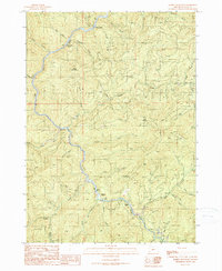
1990 Map of Rabbit Mountain
USGS Topo · Published 1990About this map
Cow Creek carves a deep, winding path through the Douglas County backcountry, serving as the central drainage for a network of family-named gulches and creeks. In the late 1980s, the landscape was marked by the remnants of earlier habitation and industry, including noted locations for Cow Creek (Site), Langdon (Site), and Brandt (Site). These sites, along with the settlement at Riffle, suggest a history of localized settlement tied to the waterways and timber.
Find a feature on this map
37 named features on this map. Tap any name to fly to it.
Don’t see what you’re looking for? This feature index may not catch every label — zoom into the map to look around manually.
Map Details
Editions of this 1990 Rabbit Mountain Map
This is the sole edition of this map. No revisions or reprints were ever made.
Other maps of this area

1904 · Riddle
USGS Topo · 1:125,000

1946 · Galice
USGS Topo · 1:62,500

1946 · Dutchman Butte
USGS Topo · 1:62,500

1948 · Galice
USGS Topo · 1:62,500

1948 · Dutchman Butte
USGS Topo · 1:62,500

1954 · Glendale
USGS Topo · 1:62,500

1954 · Canyonville
USGS Topo · 1:62,500

1955 · Medford
USGS Topo · 1:250,000

1957 · Medford
USGS Topo · 1:250,000

1958 · Medford
USGS Topo · 1:250,000