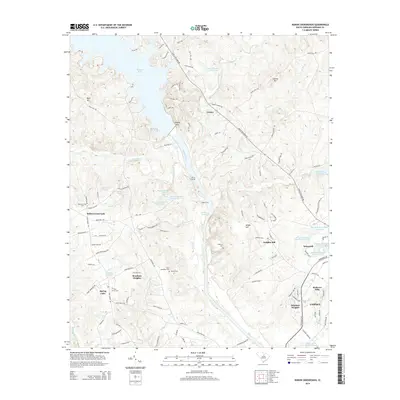
2014 Map of Rabon Crossroads
USGS Topo · Published 2014About this map
Wateree Lake and the Wateree River dominate this Kershaw County landscape, illustrating a geography defined by its waterways and crossings. The map details several historically significant transit points such as Gents Crossing and Graves Ford, which historically facilitated movement across the river before modern infrastructure was fully established. Settlement patterns are concentrated in named residential areas like Branham Heights, Eagles Nest, and the northern edge of Camden. For genealogists and local historians, the sheet is particularly valuable for its record of family-named landmarks and resting places, including Ebenezer Cem, Saint Matthews Cem, and Chestnut Cem. The topography is shaped by numerous tributaries, including Grannies Quarter Cr and Sawneys Cr, which fed into the local mill economy as evidenced by Vaughans Millpond on the eastern edge of the quadrangle.
Find a feature on this map
119 named features on this map. Tap any name to fly to it.
Don’t see what you’re looking for? This feature index may not catch every label — zoom into the map to look around manually.
Map Details
Editions of this 2014 Rabon Crossroads Map
This is the sole edition of this map. No revisions or reprints were ever made.
Other maps of this area

1935 · Camden
USGS Topo · 1:48,000

1935 · Killian
USGS Topo · 1:48,000

1937 · Killian
USGS Topo · 1:62,500

1938 · Camden
USGS Topo · 1:62,500

1938 · Hagood
USGS Topo · 1:62,500

1941 · Spartanburg
USGS Topo · 1:250,000

1942 · Camden
USGS Topo · 1:125,000

1953 · Camden South
USGS Topo · 1:24,000

1953 · Lugoff
USGS Topo · 1:24,000

1953 · Blaney
USGS Topo · 1:24,000