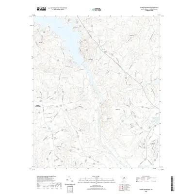
2020 Map of Rabon Crossroads
USGS Topo · Published 2020About this map
Wateree Lake and the meandering Wateree River dominate this landscape north of Camden. The map illustrates a rural South Carolina corridor defined by historic family and community landmarks, particularly evident in the concentration of burial grounds such as Ebenezer Cem, Saint Matthews Cem, and Chestnut Cem. These sites, along with small settlements like Rabon Crossroads and Cantey, provide essential reference points for genealogical research in Kershaw County.
Find a feature on this map
100 named features on this map. Tap any name to fly to it.
Don’t see what you’re looking for? This feature index may not catch every label — zoom into the map to look around manually.
Map Details
Editions of this 2020 Rabon Crossroads Map
This is the sole edition of this map. No revisions or reprints were ever made.
Other maps of this area

1935 · Camden
USGS Topo · 1:48,000

1935 · Killian
USGS Topo · 1:48,000

1937 · Killian
USGS Topo · 1:62,500

1938 · Camden
USGS Topo · 1:62,500

1938 · Hagood
USGS Topo · 1:62,500

1941 · Spartanburg
USGS Topo · 1:250,000

1942 · Camden
USGS Topo · 1:125,000

1953 · Camden South
USGS Topo · 1:24,000

1953 · Lugoff
USGS Topo · 1:24,000

1953 · Blaney
USGS Topo · 1:24,000