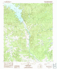
1988 Map of Rabon Crossroads
USGS Topo · Published 1988About this map
Wateree Lake and its massive Wateree Dam dominate the northern landscape of this region, where the Wateree River cuts south through Kershaw County. The geography is defined by a dense network of tributaries including Grannies Quarter Creek, Sanders Creek, and Sawneys Creek, which carve through the terrain between high points like Buck Hill and Knight Hill. This late-1980s data shows the infrastructure supporting the area's growth, from the Water Filtration Plant and various sub stations to the rural junction at Rabon Crossroads.
Find a feature on this map
26 named features on this map. Tap any name to fly to it.
Don’t see what you’re looking for? This feature index may not catch every label — zoom into the map to look around manually.
Map Details
Editions of this 1988 Rabon Crossroads Map
This is the sole edition of this map. No revisions or reprints were ever made.
Other maps of this area

1935 · Camden
USGS Topo · 1:48,000

1935 · Killian
USGS Topo · 1:48,000

1937 · Killian
USGS Topo · 1:62,500

1938 · Camden
USGS Topo · 1:62,500

1938 · Hagood
USGS Topo · 1:62,500

1941 · Spartanburg
USGS Topo · 1:250,000

1942 · Camden
USGS Topo · 1:125,000

1953 · Camden South
USGS Topo · 1:24,000

1953 · Lugoff
USGS Topo · 1:24,000

1953 · Blaney
USGS Topo · 1:24,000