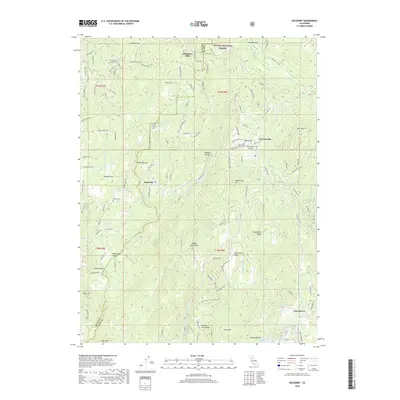
2018 Map of Rackerby
USGS Topo · Published 2018About this map
Robinson Mills and Brownsville anchor the upper reaches of this landscape where the Plumas National Forest meets the foothills. The terrain is defined by a series of deep ravines and ridges, including Chittenden Ridge and Wildcat Ravine, draining south toward Lake Mildred. The map reveals a complex network of forest roads and named lanes, such as Black Bart Rd and Ponderosa Way, which trace the high ground and creek bottoms. This 2018 survey illustrates the modern footprint of settlements like Rackerby and Frenchtown in a region characterized by its transition from timbered slopes to residential pockets. The presence of the Upham Cem and Brownsville Airport provides specific landmarks for genealogists and local historians tracking the development of this part of Yuba County.
Find a feature on this map
121 named features on this map. Tap any name to fly to it.
Don’t see what you’re looking for? This feature index may not catch every label — zoom into the map to look around manually.
Map Details
Editions of this 2018 Rackerby Map
This is the sole edition of this map. No revisions or reprints were ever made.
Other maps of this area

1888 · Smartsville
USGS Topo · 1:125,000

1888 · Bidwell Bar
USGS Topo · 1:125,000

1891 · Bidwell Bar
USGS Topo · 1:125,000

1891 · Smartsville
USGS Topo · 1:125,000

1892 · Smartsville
USGS Topo · 1:125,000

1893 · Bidwell Bar
USGS Topo · 1:125,000

1894 · Smartsville
USGS Topo · 1:125,000

1895 · Bidwell Bar
USGS Topo · 1:125,000

1895 · Smartsville
USGS Topo · 1:125,000

1897 · Bidwell Bar
USGS Topo · 1:125,000