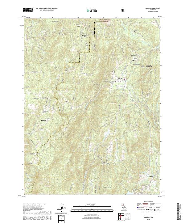
2022 Map of Rackerby
USGS Topo · Published 2022About this map
Robinson Mills and the high timber country of the Plumas National Forest define this landscape along the border of Butte and Yuba Counties. The map reveals a network of mountain communities including Brownsville, Challenge-Brownsville, and Rackerby, connected by roads like Forbestown Rd and Black Bart Rd. This area is characterized by dramatic elevation changes, where ridges like Chitterden Ridge and High Spring Ridge overlook deep ravines such as Wildcat Ravine and Smoky Ravine. Local history and genealogy are well-represented by several burial grounds, including the Brownsville Evergreen Cem, Upham Cem, and Foss Cem. Significant water features like S Honcut Cr and Willow Glen Cr drain the slopes toward Frenchtown in the southeast. The geography of the region is punctuated by prominent peaks and flats, from Sugarloaf and Parks Hill to the level expanses of Swedes Flat and Daken Flat.
Find a feature on this map
125 named features on this map. Tap any name to fly to it.
Don’t see what you’re looking for? This feature index may not catch every label — zoom into the map to look around manually.
Map Details
Editions of this 2022 Rackerby Map
This is the sole edition of this map. No revisions or reprints were ever made.
Other maps of this area

1888 · Smartsville
USGS Topo · 1:125,000

1888 · Bidwell Bar
USGS Topo · 1:125,000

1891 · Bidwell Bar
USGS Topo · 1:125,000

1891 · Smartsville
USGS Topo · 1:125,000

1892 · Smartsville
USGS Topo · 1:125,000

1893 · Bidwell Bar
USGS Topo · 1:125,000

1894 · Smartsville
USGS Topo · 1:125,000

1895 · Bidwell Bar
USGS Topo · 1:125,000

1895 · Smartsville
USGS Topo · 1:125,000

1897 · Bidwell Bar
USGS Topo · 1:125,000