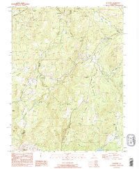
1995 Map of Rackerby
USGS Topo · Published 1995About this map
The boundary between Butte and Yuba Counties defines the landscape of this mid-1990s survey, where the western edge of Plumas National Forest meets a cluster of historical Sierra Nevada foothills settlements. Centered on Rackerby and Brownsville, the map shows a community structure rooted in nineteenth-century resource extraction and valley agriculture. Evidence of the region's mining heritage is visible in the Three in One Mine and the Manzanita Mine, while the social infrastructure of the time is preserved through landmarks like the Sharon Valley Sch, Hansonville Sch, and the New York Flat Cem. Transport and water management are critical themes, with the Brownsville Aero Pines Airport serving the area while the Sowell Flume and Honcut Creek drain the surrounding heights of Weiss Hill and Hansonville Hill. Small family-named holdings, such as Finley Ranch and Rose Ranch, dot the terrain near Frenchtown and Robinson Mills.
Find a feature on this map
50 named features on this map. Tap any name to fly to it.
Don’t see what you’re looking for? This feature index may not catch every label — zoom into the map to look around manually.
Map Details
Editions of this 1995 Rackerby Map
This is the sole edition of this map. No revisions or reprints were ever made.
Other maps of this area

1888 · Smartsville
USGS Topo · 1:125,000

1888 · Bidwell Bar
USGS Topo · 1:125,000

1891 · Bidwell Bar
USGS Topo · 1:125,000

1891 · Smartsville
USGS Topo · 1:125,000

1892 · Smartsville
USGS Topo · 1:125,000

1893 · Bidwell Bar
USGS Topo · 1:125,000

1894 · Smartsville
USGS Topo · 1:125,000

1895 · Bidwell Bar
USGS Topo · 1:125,000

1895 · Smartsville
USGS Topo · 1:125,000

1897 · Bidwell Bar
USGS Topo · 1:125,000