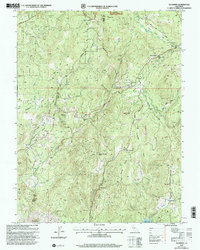
2002 Map of Rackerby
USGS Topo · Published 2003About this map
Rackerby and the surrounding foothill communities of the Plumas National Forest are documented in this detailed turn-of-the-millennium survey. The map reveals a landscape defined by its mining and timber history, with the Central Pacific Mine and Manzanita Mine situated among the drainages of Robinson Creek and Natchez Creek. The settlement pattern follows the elevation, where small rural outposts like Robinson Mills and Hansonville served local families and laborers. The topography is characterized by distinct flats and ravines, such as Lower Swedes Flat and Upham Ravine, which shaped the early road networks including La Porte Road. Genealogists will find significant value in the various burial grounds identified, including the New York Flat Cem and Brownsville Cem, alongside local educational landmarks like the Hansonville Sch.
Find a feature on this map
65 named features on this map. Tap any name to fly to it.
Don’t see what you’re looking for? This feature index may not catch every label — zoom into the map to look around manually.
Map Details
Editions of this 2002 Rackerby Map
This is the sole edition of this map. No revisions or reprints were ever made.
Other maps of this area

1888 · Smartsville
USGS Topo · 1:125,000

1888 · Bidwell Bar
USGS Topo · 1:125,000

1891 · Bidwell Bar
USGS Topo · 1:125,000

1891 · Smartsville
USGS Topo · 1:125,000

1892 · Smartsville
USGS Topo · 1:125,000

1893 · Bidwell Bar
USGS Topo · 1:125,000

1894 · Smartsville
USGS Topo · 1:125,000

1895 · Bidwell Bar
USGS Topo · 1:125,000

1895 · Smartsville
USGS Topo · 1:125,000

1897 · Bidwell Bar
USGS Topo · 1:125,000