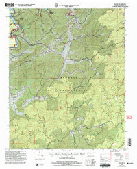
2003 Map of Rafter
USGS Topo · Published 2004About this map
Tellico Lake occupies the northwestern corner of this landscape, a result of the impoundment of the Little Tennessee River and its tributaries. The topography is defined by the heavy ridges of the Cherokee National Forest, including Birchfield Mountain, Harlan Mountain, and Mose Mountain. Small settlements and family clusters like Tellico, Acorn, and Rafter are dispersed through the valleys, often centered around rural institutions such as Ballplay School and Ebenezer Ballplay Church.
Find a feature on this map
74 named features on this map. Tap any name to fly to it.
Don’t see what you’re looking for? This feature index may not catch every label — zoom into the map to look around manually.
Map Details
Editions of this 2003 Rafter Map
This is the sole edition of this map. No revisions or reprints were ever made.
Other maps of this area

1893 · Murphy
USGS Topo · 1:125,000

1895 · Loudon
USGS Topo · 1:125,000

1914 · Murphy
USGS Topo · 1:125,000

1927 · Big Junction
USGS Topo · 1:24,000

1933 · Haw Knob
USGS Topo · 1:48,000

1933 · Whiteoak Flats
USGS Topo · 1:24,000

1933 · Bald River Falls
USGS Topo · 1:24,000

1933 · Rafter
USGS Topo · 1:24,000

1934 · Mount Vernon
USGS Topo · 1:24,000

1934 · Tellico Plains
USGS Topo · 1:24,000