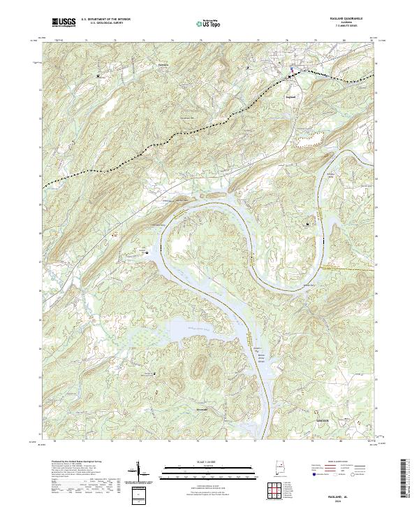
2024 Map of Ragland
USGS Topo · Published 2024About this map
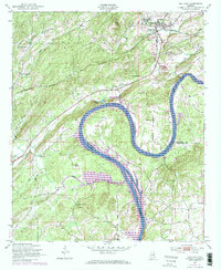
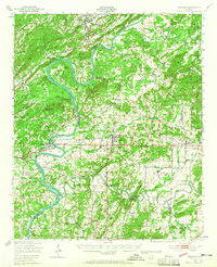
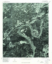
The Coosa River defines the landscape as it winds through the heart of this region, creating distinctive landforms such as Embry Bend and Kirkseys Bend. The waterway served as a critical corridor for transport and industry, evidenced by the location of Mitchells Ferry and Woods Ferry, and the historic industrial footprint of Greens Mill near Broken Arrow Shoals. Settlement patterns are anchored by Ragland to the north and Riverside to the south, connected by the rail lines of CSX Transportation. Family history is preserved across numerous burial sites, including Old Mitchell Cem and the Garden of Memories Cem. The terrain rises toward Henderson Mtn, while the boundary between St. Clair, Talladega, and Calhoun counties converges along the river's path, marking a significant geographical junction.
Find a feature on this map
107 named features on this map. Tap any name to fly to it.
Don’t see what you’re looking for? This feature index may not catch every label — zoom into the map to look around manually.
Map Details
Editions of this 2024 Ragland Map
This is the sole edition of this map. No revisions or reprints were ever made.
Historical Maps of Embry Bend Through Time
4 maps found