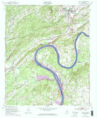
1947 Map of Ragland
USGS Topo · Published 1973About this map
The Coosa River defines the landscape of this survey, winding through the sharp curve of Embry Bend before expanding into Logan Martin Lake. In the northern portion of the map, the town of Ragland serves as a hub for industry and transport, featuring a long Conveyor Belt and the Seaboard Coast Line railroad. This industrial activity is contrasted by a dense network of rural community landmarks, including Rhodes Chapel, New Prospect Ch, and Robinson Sch.
Find a feature on this map
29 named features on this map. Tap any name to fly to it.
Don’t see what you’re looking for? This feature index may not catch every label — zoom into the map to look around manually.
Map Details
Editions of this 1947 Ragland Map
4 editions found
Other maps of this area

1889 · Springville
USGS Topo · 1:125,000

1892 · Springville
USGS Topo · 1:125,000

1947 · Cox Gap
USGS Topo · 1:24,000

1947 · Eastaboga
USGS Topo · 1:24,000

1947 · Ragland
USGS Topo · 1:62,500

1947 · Ragland
USGS Topo · 1:24,000

1947 · Riverside
USGS Topo · 1:24,000

1947 · Francis Mill
USGS Topo · 1:24,000

1947 · Steele
USGS Topo · 1:62,500
1949 · Ohatchee
USGS Topo · 1:24,000