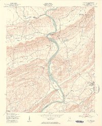
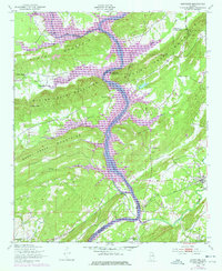
1949 Map of Ohatchee
USGS Topo · Published 1953About this map
The Coosa River carves a deep valley through the Appalachian ridges of Alabama, serving as a political and topographical boundary between St. Clair, Etowah, and Calhoun counties. The river remains a primary corridor for commerce and transport in the late 1940s, marked by Woods Island and the critical crossing at Francis Ferry. The Seaboard Air Line railroad parallels the river's eastern bank, connecting small settlements like Francis and Ohatchee to the broader regional economy.
Find a feature on this map
39 named features on this map. Tap any name to fly to it.
Don’t see what you’re looking for? This feature index may not catch every label — zoom into the map to look around manually.
Map Details
Editions of this 1949 Ohatchee Map
5 editions found
Other maps of this area

1889 · Springville
USGS Topo · 1:125,000

1892 · Springville
USGS Topo · 1:125,000

1900 · Anniston
USGS Topo · 1:125,000

1947 · Cox Gap
USGS Topo · 1:24,000

1947 · Dunaway Mountain
USGS Topo · 1:24,000

1947 · Ragland
USGS Topo · 1:62,500

1947 · Ragland
USGS Topo · 1:24,000

1947 · Glencoe
USGS Topo · 1:24,000

1947 · Wellington
USGS Topo · 1:24,000

1947 · Francis Mill
USGS Topo · 1:24,000