
1947 Map of Riverside
USGS Topo · Published 1953About this map
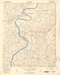
The Coosa River defines the landscape of this 1947 survey, carving a winding path that serves as the boundary between St. Clair and Talladega counties. In this era before major modern impoundments fully reshaped the river valley, the waterway remains a central focus of rural life, evidenced by the presence of Lock No 5 (Abandoned) and the large Ogletree Island. The town of Riverside and the settlement of Seddon are positioned along the Southern railroad line, which provides a vital transportation corridor parallel to the river. The interior reaches are densely dotted with small community landmarks, including New Life Sch and Idelia Sch, alongside numerous country churches such as Blooming Light Ch, Stemley Rock Ch, and Rushing Spring Ch. These features illustrate a mid-century Alabama landscape where social and religious life was deeply rooted in small, local congregations and schoolhouses.
Find a feature on this map
29 named features on this map. Tap any name to fly to it.
Don’t see what you’re looking for? This feature index may not catch every label — zoom into the map to look around manually.
Map Details
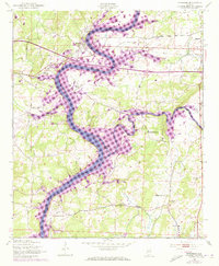
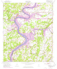
Editions of this 1947 Riverside Map
4 editions found
Other maps of this area

1889 · Springville
USGS Topo · 1:125,000

1890 · Talladega
USGS Topo · 1:125,000

1892 · Springville
USGS Topo · 1:125,000

1892 · Talladega
USGS Topo · 1:125,000

1943 · Talladega
USGS Topo · 1:62,500

1946 · Talladega
USGS Topo · 1:62,500

1947 · Eastaboga
USGS Topo · 1:24,000

1947 · Ragland
USGS Topo · 1:62,500

1947 · Ragland
USGS Topo · 1:24,000

1947 · Francis Mill
USGS Topo · 1:24,000