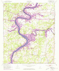
1947 Map of Riverside
USGS Topo · Published 1973About this map
The Coosa River defines the landscape of this survey, serving as the border between St. Clair and Talladega counties. In the north, the town of Riverside is positioned where the Southern railroad crosses the river, a critical junction for the area's transport and industry. The map illustrates a dense network of local landmarks, including numerous country churches such as Macedonia Ch and Pleasant Grove Ch, alongside rural schools like Idelia Sch and New Life Sch. Significant purple revisions from the early 1970s indicate the expansion of H Logan Lake and the flooding of the lower Choccolocco Creek basin, showing the transformation of the river valley into a reservoir system. Notable landmarks such as the St Clair County Airport and Ogletree Island highlight the mix of modern aviation and natural river features.
Find a feature on this map
30 named features on this map. Tap any name to fly to it.
Don’t see what you’re looking for? This feature index may not catch every label — zoom into the map to look around manually.
Map Details
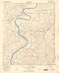
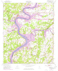
Editions of this 1947 Riverside Map
4 editions found
Other maps of this area

1889 · Springville
USGS Topo · 1:125,000

1890 · Talladega
USGS Topo · 1:125,000

1892 · Springville
USGS Topo · 1:125,000

1892 · Talladega
USGS Topo · 1:125,000

1943 · Talladega
USGS Topo · 1:62,500

1946 · Talladega
USGS Topo · 1:62,500

1947 · Eastaboga
USGS Topo · 1:24,000

1947 · Ragland
USGS Topo · 1:62,500

1947 · Ragland
USGS Topo · 1:24,000

1947 · Riverside
USGS Topo · 1:24,000