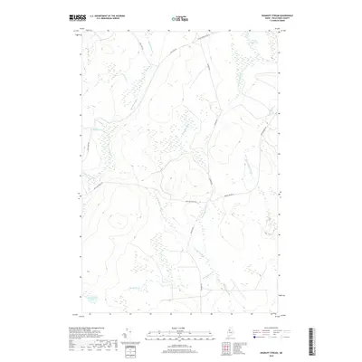
2018 Map of Ragmuff Stream
USGS Topo · Published 2018About this map
Ragmuff Stream and its tributary Little Ragmuff Stream define the drainage of this Piscataquis County timberland landscape. The area is characterized by a network of logging and winter roads, including Black Pond Winter Rd and Loon Lake Rd, which provide the primary access through the dense wetland and forest terrain. Water bodies such as McGooseley Pond and the small Little Scott Pond are centers for local hydrology, feeding into various named brooks. Notable for the genealogist or local historian are the several family-named or descriptively named watercourses, such as Dead Man Brook and Big Scott Brook, which suggest the historic human presence and working history of these Maine woods. The naming of Dead Man Brook Rd and Scott Brook Rd further underscores how these natural features dictated the early transportation routes through the township.
Find a feature on this map
19 named features on this map. Tap any name to fly to it.
Don’t see what you’re looking for? This feature index may not catch every label — zoom into the map to look around manually.
Map Details
Editions of this 2018 Ragmuff Stream Map
This is the sole edition of this map. No revisions or reprints were ever made.
Other maps of this area

1954 · Chesuncook
USGS Topo · 1:62,500

1954 · North East Carry
USGS Topo · 1:62,500

1954 · Caucomgomoc Lake
USGS Topo · 1:62,500

1954 · Grant Farm
USGS Topo · 1:62,500

1954 · Presque Isle
USGS Topo · 1:250,000

1954 · Millinocket
USGS Topo · 1:250,000

1958 · Presque Isle
USGS Topo · 1:250,000

1958 · Millinocket
USGS Topo · 1:250,000

1958 · Chesuncook
USGS Topo · 1:62,500

1958 · Caucomgomoc Lake
USGS Topo · 1:62,500