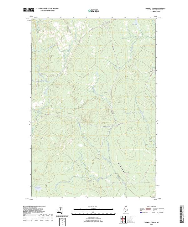
2024 Map of Ragmuff Stream
USGS Topo · Published 2024About this map
Ragmuff Stream flows through this North Woods landscape in Piscataquis County, defined by its intricate network of waterways and timber-management corridors. The presence of Ragmuff Airport serves as a key landmark in this otherwise undeveloped territory, where the terrain is segmented by specialized routes like Black Pond Winter Rd. The hydrology of the area is exceptionally dense, with numerous brooks such as Big Scott Brook and North Brook feeding into larger systems. This modern survey captures the drainage patterns and land-use infrastructure essential for navigating the Maine interior, from the secluded waters of McGooseley Pond in the southwest to the elevated reaches near Loon Lake.
Find a feature on this map
21 named features on this map. Tap any name to fly to it.
Don’t see what you’re looking for? This feature index may not catch every label — zoom into the map to look around manually.
Map Details
Editions of this 2024 Ragmuff Stream Map
This is the sole edition of this map. No revisions or reprints were ever made.
Other maps of this area

1954 · Chesuncook
USGS Topo · 1:62,500

1954 · North East Carry
USGS Topo · 1:62,500

1954 · Caucomgomoc Lake
USGS Topo · 1:62,500

1954 · Grant Farm
USGS Topo · 1:62,500

1954 · Presque Isle
USGS Topo · 1:250,000

1954 · Millinocket
USGS Topo · 1:250,000

1958 · Presque Isle
USGS Topo · 1:250,000

1958 · Millinocket
USGS Topo · 1:250,000

1958 · Chesuncook
USGS Topo · 1:62,500

1958 · Caucomgomoc Lake
USGS Topo · 1:62,500