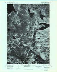
1978 Map of Rainbow Lake West
USGS Topo · Published 1981About this map
Nahmakanta Lake and Rainbow Lake dominate this 1978 orthophotoquad, which uses aerial photography to reveal the dense timberlands and complex water systems of the Maine woods. Unlike traditional line-drawn maps, this image provides a direct view of the forest canopy and shorelines as they appeared in the late 1970s. The landscape is defined by its glacial hydrology, from the broad waters of Chesuncook Lake in the northwest to smaller, isolated basins like Pollywog Pond and Holbrook Pond. Linear features cutting through the vegetation suggest logging roads or survey lines, providing evidence of the working forest economy. The intricate chain of the Bean Ponds demonstrates the topographical texture of this remote region before modern development patterns altered these traditional woodland environments.
Find a feature on this map
7 named features on this map. Tap any name to fly to it.
Don’t see what you’re looking for? This feature index may not catch every label — zoom into the map to look around manually.
Map Details
Editions of this 1978 Rainbow Lake West Map
This is the sole edition of this map. No revisions or reprints were ever made.
Other maps of this area

1952 · Jo-Mary Mountain
USGS Topo · 1:62,500

1952 · First Roach Pond
USGS Topo · 1:62,500

1954 · Grant Farm
USGS Topo · 1:62,500

1954 · Harrington Lake
USGS Topo · 1:62,500

1954 · Millinocket
USGS Topo · 1:250,000

1958 · Millinocket
USGS Topo · 1:250,000

1960 · Millinocket
USGS Topo · 1:250,000
1978 · Caribou Lake South
USGS Topo · 1:24,000
1978 · Wadleigh Mountain
USGS Topo · 1:24,000
1978 · Farrar Mountain
USGS Topo · 1:24,000