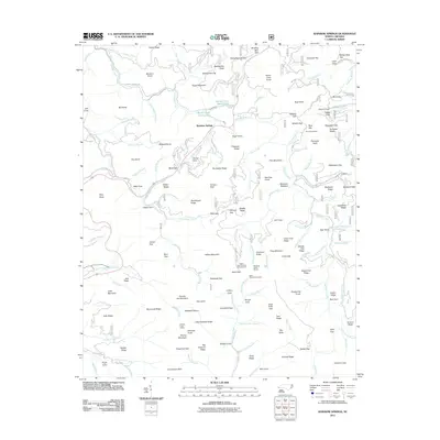
2011 Map of Rainbow Springs
USGS Topo · Published 2011About this map
The Nantahala River winds through this high-elevation terrain in Macon County, defining a landscape of steep ridges and deep gaps. In the early 21st century, the settlement of Rainbow Springs sits at the junction of Rainbow Springs Rd and the river, marking a historic area of mountain passage. The geography is characterized by high summits like Chunky Gal Mountain, Kimsey Bald, and Buzzard Knob, which overlook numerous water sources including the Moore Creek Upper Lake and Moore Creek Lower Lake. Local history and recreation intersect at established sites such as the Deep Gap Campground and Standing Indian Shelter. The map also details numerous family-named landmarks and geographic features like Penland Gap, Crawford Flats, and Hogan Cove, offering a view of the intricate topography and named branches that feed the river system.
Find a feature on this map
157 named features on this map. Tap any name to fly to it.
Don’t see what you’re looking for? This feature index may not catch every label — zoom into the map to look around manually.
Map Details
Editions of this 2011 Rainbow Springs Map
This is the sole edition of this map. No revisions or reprints were ever made.
Other maps of this area

1886 · Dahlonega
USGS Topo · 1:125,000

1886 · Walhalla
USGS Topo · 1:125,000

1891 · Cowee
USGS Topo · 1:125,000

1892 · Dahlonega
USGS Topo · 1:125,000

1892 · Walhalla
USGS Topo · 1:125,000

1896 · Walhalla
USGS Topo · 1:125,000

1896 · Dahlonega
USGS Topo · 1:125,000

1897 · Cowee
USGS Topo · 1:125,000

1903 · Dahlonega
USGS Topo · 1:125,000

1907 · Cowee
USGS Topo · 1:125,000