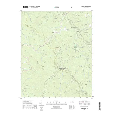
2019 Map of Rainbow Springs
USGS Topo · Published 2019About this map
Rainbow Springs serves as a focal point within the high elevations of the Nantahala National Forest, where the headwaters of the Nantahala River are joined by numerous named mountain branches and creeks. This 2019 survey captures the convergence of natural waterways and religious history, notably at the Ascension Chapel Episcopal and its adjacent graveyard. The terrain is defined by a dense network of gaps and coves, including Rattlesnake Gap, Winding Stair Gap, and Poplar Cove, which dictated the early travel routes through the Blue Ridge. The Appalachian National Scenic Trail winds extensively through the landscape, crossing peaks like Wateroak Gap and skirting the Macon and Clay County border. Settlement patterns are sparse, represented by Whiteoak Bottoms and the small lakes at Moore Cr Lower Lake, reflecting a region largely preserved for timber and recreation.
Find a feature on this map
121 named features on this map. Tap any name to fly to it.
Don’t see what you’re looking for? This feature index may not catch every label — zoom into the map to look around manually.
Map Details
Editions of this 2019 Rainbow Springs Map
This is the sole edition of this map. No revisions or reprints were ever made.
Other maps of this area

1886 · Dahlonega
USGS Topo · 1:125,000

1886 · Walhalla
USGS Topo · 1:125,000

1891 · Cowee
USGS Topo · 1:125,000

1892 · Dahlonega
USGS Topo · 1:125,000

1892 · Walhalla
USGS Topo · 1:125,000

1896 · Walhalla
USGS Topo · 1:125,000

1896 · Dahlonega
USGS Topo · 1:125,000

1897 · Cowee
USGS Topo · 1:125,000

1903 · Dahlonega
USGS Topo · 1:125,000

1907 · Cowee
USGS Topo · 1:125,000