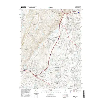
2014 Map of Ramsey
USGS Topo · Published 2014About this map
The Ramapo River cuts through this borderlands region where the Ramapo Mountains meet the developed suburbs of Bergen and Rockland counties. This 2014 survey captures a densely networked landscape of late-modern residential expansion intertwined with historic industrial and religious sites. Significant land-use patterns are visible in the clusters of historic mill sites such as Pulis Mills, Ackermans Mills, and Ferdinands Mills, which signify the area's deep-rooted water-powered history.
Find a feature on this map
125 named features on this map. Tap any name to fly to it.
Don’t see what you’re looking for? This feature index may not catch every label — zoom into the map to look around manually.
Map Details
Editions of this 2014 Ramsey Map
This is the sole edition of this map. No revisions or reprints were ever made.
Other maps of this area

1888 · Morristown
USGS Topo · 1:62,500

1888 · Paterson
USGS Topo · 1:62,500

1891 · Greenwood Lake
USGS Topo · 1:62,500

1891 · Ramapo
USGS Topo · 1:62,500

1892 · Paterson
USGS Topo · 1:62,500

1893 · Greenwood Lake
USGS Topo · 1:62,500

1893 · Ramapo
USGS Topo · 1:62,500

1894 · Morristown
USGS Topo · 1:62,500

1898 · Morristown
USGS Topo · 1:62,500

1898 · Paterson
USGS Topo · 1:62,500