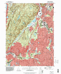
1995 Map of Ramsey
USGS Topo · Published 1998About this map
Ramapo Mountain State Forest and the Campgaw Mountain County Reservation dominate the western Highlands, where the terrain breaks sharply into the developed suburban corridors of Bergen County. This mid-1990s record of the area captures the dense network of roadways like New Jersey State Highway 17 and Interstate 287 that facilitated the growth of Ramsey, Mahwah, and Wyckoff. The map reveals a landscape balancing heavy infrastructure with institutional and recreational preserves, including the Immaculate Conception Seminary and the Don Bosco Institute.
Find a feature on this map
133 named features on this map. Tap any name to fly to it.
Don’t see what you’re looking for? This feature index may not catch every label — zoom into the map to look around manually.
Map Details
Editions of this 1995 Ramsey Map
This is the sole edition of this map. No revisions or reprints were ever made.
Other maps of this area

1888 · Morristown
USGS Topo · 1:62,500

1888 · Paterson
USGS Topo · 1:62,500

1891 · Greenwood Lake
USGS Topo · 1:62,500

1891 · Ramapo
USGS Topo · 1:62,500

1892 · Paterson
USGS Topo · 1:62,500

1893 · Greenwood Lake
USGS Topo · 1:62,500

1893 · Ramapo
USGS Topo · 1:62,500

1894 · Morristown
USGS Topo · 1:62,500

1898 · Morristown
USGS Topo · 1:62,500

1898 · Paterson
USGS Topo · 1:62,500