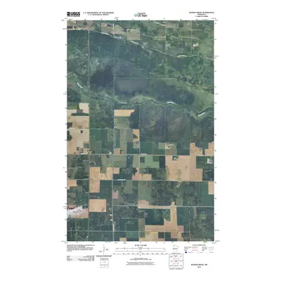
2010 Map of Randen Ridge
USGS Topo · Published 2010About this map
Randeen Cemetery stands as a quiet focal point in this portion of Marshall County, situated near the intersection of 350th Ave NE and Ranson Ridge Rd. The landscape is defined by the subtle elevation of Randen Ridge, which influences the local drainage and road patterns. The Moose River meanders across the central terrain, cutting a horizontal path through the agricultural grid. This 2010 survey illustrates a sparsely populated region of northern Minnesota where the road network, including County Hwy-133 and County Hwy-53, follows a strict section-line hierarchy typical of the prairie's development, preserving the isolation of family-named landmarks and small burial grounds.
Find a feature on this map
10 named features on this map. Tap any name to fly to it.
Don’t see what you’re looking for? This feature index may not catch every label — zoom into the map to look around manually.
Map Details
Editions of this 2010 Randen Ridge Map
This is the sole edition of this map. No revisions or reprints were ever made.
Other maps of this area

1918 · Rollis
USGS Topo · 1:62,500

1918 · Pencer
USGS Topo · 1:62,500

1918 · Garland
USGS Topo · 1:62,500

1919 · Liner
USGS Topo · 1:62,500

1943 · Rollis
USGS Topo · 1:62,500

1954 · Roseau
USGS Topo · 1:250,000

1957 · Roseau
USGS Topo · 1:250,000

1958 · Roseau
USGS Topo · 1:250,000

1962 · Gatzke SE
USGS Topo · 1:24,000

1962 · Gatzke
USGS Topo · 1:24,000