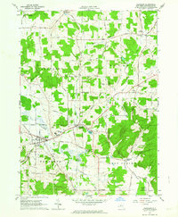
1962 Map of Randolph
USGS Topo · Published 1964About this map
Randolph and East Randolph serve as the primary hubs in this corner of Cattaraugus County, situated along the Erie-Lackawanna Railroad and the banks of Little Conewango Creek. The local economy of the early 1960s is evidenced by the State Fish Hatchery and numerous Gravel Pits dotting the landscape. In the southeast, the Allegany Indian Reservation begins near Bunker Hill, while the northern hills are home to small hamlets like Axeville and Napoli.
Find a feature on this map
80 named features on this map. Tap any name to fly to it.
Don’t see what you’re looking for? This feature index may not catch every label — zoom into the map to look around manually.
Map Details
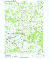
Editions of this 1962 Randolph Map
2 editions found
Other maps of this area

1900 · Cherry Creek
USGS Topo · 1:62,500

1905 · Jamestown
USGS Topo · 1:62,500

1922 · Randolph
USGS Topo · 1:62,500

1923 · Randolph
USGS Topo · 1:62,500

1923 · Cattaraugus
USGS Topo · 1:62,500

1938 · Cattaraugus
USGS Topo · 1:62,500

1941 · Cattaraugus
USGS Topo · 1:62,500

1941 · Cherry Creek
USGS Topo · 1:62,500

1942 · Jamestown
USGS Topo · 1:62,500

1943 · Randolph
USGS Topo · 1:62,500