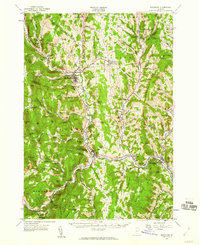
1957 Map of Randolph
USGS Topo · Published 1960About this map
The White River and its multiple branches dictate the settlement patterns of this central Vermont landscape, where the Central Vermont railroad follows the valley through Randolph and South Royalton. The map reveals a robust educational infrastructure at mid-century, anchored by the State Sch of Agriculture in Randolph Center and several regional institutions like Whitcomb High Sch and the Union High Sch.
Find a feature on this map
116 named features on this map. Tap any name to fly to it.
Don’t see what you’re looking for? This feature index may not catch every label — zoom into the map to look around manually.
Map Details
Editions of this 1957 Randolph Map
3 editions found
Other maps of this area

1891 · Rutland
USGS Topo · 1:62,500

1893 · Rutland
USGS Topo · 1:62,500

1896 · Strafford
USGS Topo · 1:62,500

1906 · Hanover
USGS Topo · 1:62,500

1908 · Hanover
USGS Topo · 1:62,500

1911 · Woodstock
USGS Topo · 1:62,500

1913 · Woodstock
USGS Topo · 1:62,500

1915 · Rochester
USGS Topo · 1:62,500

1917 · Rochester
USGS Topo · 1:62,500

1919 · Royalton
USGS Topo · 1:62,500