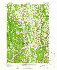
1957 Map of Randolph
USGS Topo · Published 1964About this map
The Central Vermont railroad corridor serves as the industrial and transit spine of this landscape, following the narrow valleys of the White River and its various branches. This 1957 revision highlights a mid-century period when the region balanced its agrarian roots with modernizing infrastructure, such as the State Sch of Agriculture in Randolph Center and the Drive-in Theater near Bethel. The map reveals the intricate network of valley settlements, from the manufacturing hub of Randolph to smaller hamlets like East Braintree and Gaysville.
Find a feature on this map
126 named features on this map. Tap any name to fly to it.
Don’t see what you’re looking for? This feature index may not catch every label — zoom into the map to look around manually.
Map Details
Editions of this 1957 Randolph Map
3 editions found
Other maps of this area

1891 · Rutland
USGS Topo · 1:62,500

1893 · Rutland
USGS Topo · 1:62,500

1896 · Strafford
USGS Topo · 1:62,500

1906 · Hanover
USGS Topo · 1:62,500

1908 · Hanover
USGS Topo · 1:62,500

1911 · Woodstock
USGS Topo · 1:62,500

1913 · Woodstock
USGS Topo · 1:62,500

1915 · Rochester
USGS Topo · 1:62,500

1917 · Rochester
USGS Topo · 1:62,500

1919 · Royalton
USGS Topo · 1:62,500