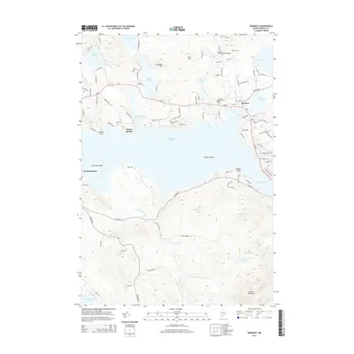
2014 Map of Rangeley
USGS Topo · Published 2014About this map
Rangeley Lake anchors this 2014 survey of the western Maine highlands, where the settlement of Rangeley sits on the northeastern shore between City Cove and Haley Pond. The map illustrates a landscape defined by significant water bodies and high relief, ranging from the northern peaks of Burnham Hill and Chick Hill to the southern mass of Beaver Mountain. Transport and infrastructure are concentrated along the northern lakefront, featuring the Steven A. Bean Municipal Airport and the historic Rangeley Village Cem.
Find a feature on this map
104 named features on this map. Tap any name to fly to it.
Don’t see what you’re looking for? This feature index may not catch every label — zoom into the map to look around manually.
Map Details
Editions of this 2014 Rangeley Map
This is the sole edition of this map. No revisions or reprints were ever made.
Other maps of this area

1931 · Cupsuptic
USGS Topo · 1:48,000

1932 · Kennebago Lake
USGS Topo · 1:48,000

1933 · Rangeley
USGS Topo · 1:48,000

1934 · Cupsuptic
USGS Topo · 1:62,500

1935 · Kennebago Lake
USGS Topo · 1:62,500

1935 · Cupsuptic
USGS Topo · 1:62,500

1936 · Kennebago Lake
USGS Topo · 1:62,500

1939 · Rangeley
USGS Topo · 1:62,500

1940 · Oquossoc
USGS Topo · 1:62,500

1942 · Oquossoc
USGS Topo · 1:62,500
Featured Places
- Rangeley, ME
- Dallas Plantation, ME
- Rangeley Plantation, ME
- Sandy River Plantation, ME
- Franklin County, ME