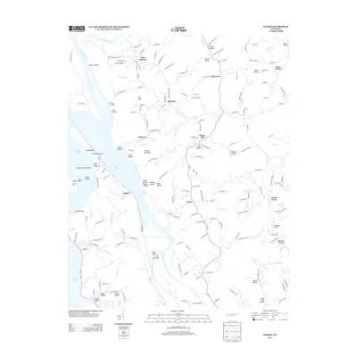
2013 Map of Rankin
USGS Topo · Published 2013About this map
Douglas Lake dominates the western edge of this landscape, its fluctuating shoreline defining the local geography at the confluence of the Nolichucky River, French Broad River, and Pigeon River. This 2013 survey illustrates the intricate network of hollows and ridges that characterize this part of East Tennessee, showing how small communities like Redwine, Bybee, and Point Pleasant are tucked into the valleys. The map reveals the agricultural and residential patterns of the area, featuring named land tracts such as Fairfax Farm and the alluvial flats of Irish Bottoms and Rankin Bottoms. The terrain is marked by numerous family-named features like Webb Hollow and Baysinger Hollow, while remnants of the river's original character are preserved in labels like Chunns Shoals and Robinson Ford Shoals, providing a detailed view of the regional topography before and after the creation of the reservoir.
Find a feature on this map
183 named features on this map. Tap any name to fly to it.
Don’t see what you’re looking for? This feature index may not catch every label — zoom into the map to look around manually.
Map Details
Editions of this 2013 Rankin Map
This is the sole edition of this map. No revisions or reprints were ever made.
Other maps of this area

1883 · Morristown
USGS Topo · 1:125,000

1893 · Mt Guyot
USGS Topo · 1:125,000

1893 · Morristown
USGS Topo · 1:125,000

1895 · Morristown
USGS Topo · 1:125,000

1912 · Mt Guyot
USGS Topo · 1:125,000

1935 · Newport
USGS Topo · 1:48,000

1935 · White Pine
USGS Topo · 1:24,000

1935 · English Mountain
USGS Topo · 1:48,000

1935 · Parrottsville
USGS Topo · 1:24,000

1935 · Neddy Mountain
USGS Topo · 1:24,000