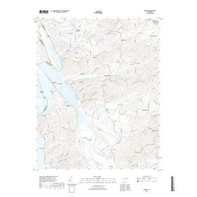
2019 Map of Rankin
USGS Topo · Published 2019About this map
Douglas Lake dominates the western landscape of this Tennessee survey, where the waters submerge the historic confluence of several major river systems. The Nolichucky River, French Broad River, and Pigeon River all meet in this valley, creating a network of bottoms and shoals like Chunns Shoals and Ten Island Shoals. The settlement of Rankin sits near the shore, surrounded by numerous family burial grounds including Calfee Cem and Rogers Cem, which serve as vital markers for local genealogical research. In the upland areas to the east, the terrain is defined by a series of hollows and ridges, such as Fowler Ridge and Cooper Hollow, where small communities like Bybee, Redwine, and Point Pleasant are connected by historic routes like Old Solomon Ferry Rd and Leepers Ferry Rd.
Find a feature on this map
152 named features on this map. Tap any name to fly to it.
Don’t see what you’re looking for? This feature index may not catch every label — zoom into the map to look around manually.
Map Details
Editions of this 2019 Rankin Map
This is the sole edition of this map. No revisions or reprints were ever made.
Other maps of this area

1883 · Morristown
USGS Topo · 1:125,000

1893 · Mt Guyot
USGS Topo · 1:125,000

1893 · Morristown
USGS Topo · 1:125,000

1895 · Morristown
USGS Topo · 1:125,000

1912 · Mt Guyot
USGS Topo · 1:125,000

1935 · Newport
USGS Topo · 1:48,000

1935 · White Pine
USGS Topo · 1:24,000

1935 · English Mountain
USGS Topo · 1:48,000

1935 · Parrottsville
USGS Topo · 1:24,000

1935 · Neddy Mountain
USGS Topo · 1:24,000