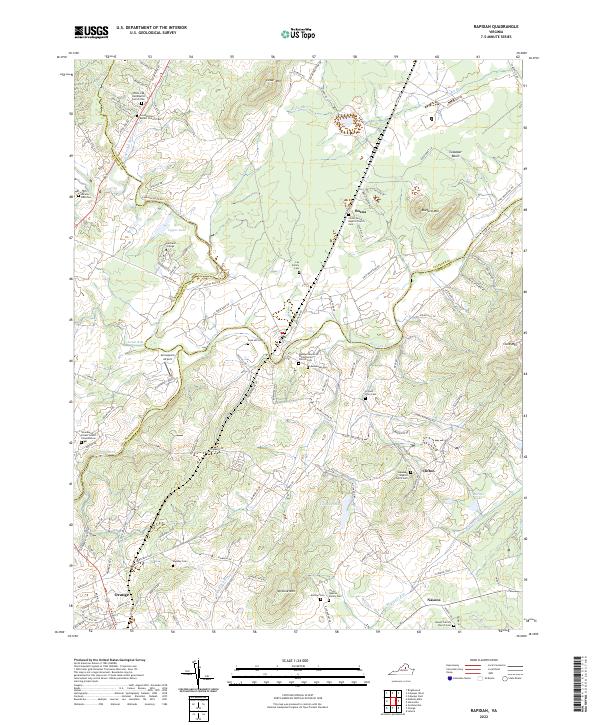
2022 Map of Rapidan
USGS Topo · Published 2022About this map
The Rapidan River and Robinson River converge in this Piedmont landscape, defining the boundaries where Culpeper, Madison, and Orange Counties meet. Significant for genealogists, the terrain is marked by numerous family-named landmarks and burial sites, including the Taylor-Quarles Family Cem, Lay Family Cem, and Arjalon Price Cem. The map illustrates a community anchored by historic congregations such as Waddell Memorial Presbyterian Church and Hopewell Baptist Church. Educational and institutional presence is noted through the Woodberry Forest School Columbarium and Hartland College. Between the prominent heights of Jerdone Mtn and Clark Mtn, the Culpeper Basin creates a distinct geological profile. The settlement patterns around Buena, Clifton, and the northern edge of Orange reflect a rural network of small crossroads and family holdings that have shaped this portion of Virginia for generations.
Find a feature on this map
115 named features on this map. Tap any name to fly to it.
Don’t see what you’re looking for? This feature index may not catch every label — zoom into the map to look around manually.
Map Details
Editions of this 2022 Rapidan Map
This is the sole edition of this map. No revisions or reprints were ever made.
Other maps of this area

1887 · Spottsylvania
USGS Topo · 1:125,000

1892 · Spottsylvania
USGS Topo · 1:125,000

1892 · Gordonsville
USGS Topo · 1:125,000

1942 · Lahore
USGS Topo · 1:31,680

1943 · Culpeper
USGS Topo · 1:24,000

1943 · Unionville
USGS Topo · 1:24,000
1944 · Culpeper
USGS Topo · 1:31,680
1944 · Unionville
USGS Topo · 1:31,680

1948 · Washington
USGS Topo · 1:250,000

1949 · Charlottesville
USGS Topo · 1:250,000