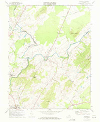
1971 Map of Rapidan
USGS Topo · Published 1972About this map
The Rapidan River and Robinson River converge in this Piedmont landscape, defining the borders between Madison, Culpeper, and Orange Counties. The Southern railroad serves as a central spine for the region, connecting the larger town of Orange in the south to the riverside community of Rapidan and the settlement of Buena. The presence of several historic congregations, including Emmanuel Ch, White Oak Run Ch, and Cedar Grove Ch, speaks to the established rural social structure of the early 1970s.
Find a feature on this map
37 named features on this map. Tap any name to fly to it.
Don’t see what you’re looking for? This feature index may not catch every label — zoom into the map to look around manually.
Map Details
Editions of this 1971 Rapidan Map
2 editions found
Other maps of this area

1887 · Spottsylvania
USGS Topo · 1:125,000

1892 · Spottsylvania
USGS Topo · 1:125,000

1892 · Gordonsville
USGS Topo · 1:125,000

1942 · Lahore
USGS Topo · 1:31,680

1943 · Culpeper
USGS Topo · 1:24,000

1943 · Unionville
USGS Topo · 1:24,000
1944 · Culpeper
USGS Topo · 1:31,680
1944 · Unionville
USGS Topo · 1:31,680

1948 · Washington
USGS Topo · 1:250,000

1949 · Charlottesville
USGS Topo · 1:250,000