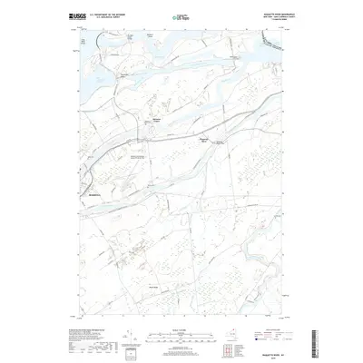
2019 Map of Raquette River
USGS Topo · Published 2019About this map
Eisenhower Lock and Snell Lock anchor the maritime infrastructure along the Saint Lawrence Seaway, illustrating the engineered transformation of the northern border near the international boundary with Canada. This 2019 survey captures the convergence of the Wiley Dondero Canal, Grass River, and Raquette River as they thread through the landscape toward Lake St Francis. The map reveals a dense network of local routes like Massena-Helena Rd and N Racquette River Rd, which connect established settlements such as Massena Center and the village of Raquette River.
Find a feature on this map
77 named features on this map. Tap any name to fly to it.
Don’t see what you’re looking for? This feature index may not catch every label — zoom into the map to look around manually.
Map Details
Editions of this 2019 Raquette River Map
This is the sole edition of this map. No revisions or reprints were ever made.
Other maps of this area

1906 · Massena
USGS Topo · 1:62,500

1907 · Massena
USGS Topo · 1:62,500

1915 · Moira
USGS Topo · 1:62,500

1917 · Moira
USGS Topo · 1:62,500

1942 · Norfolk
USGS Topo · 1:24,000

1942 · Barnhart Island
USGS Topo · 1:24,000

1942 · Massena
USGS Topo · 1:24,000

1943 · Barnhart Island
USGS Topo · 1:31,680
1943 · Massena
USGS Topo · 1:31,680
1943 · Norfolk
USGS Topo · 1:31,680