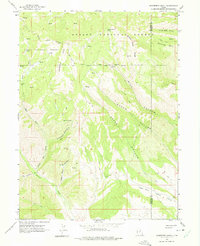
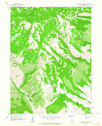
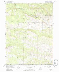
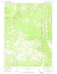
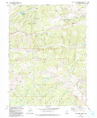
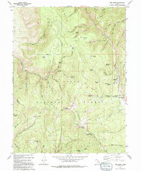
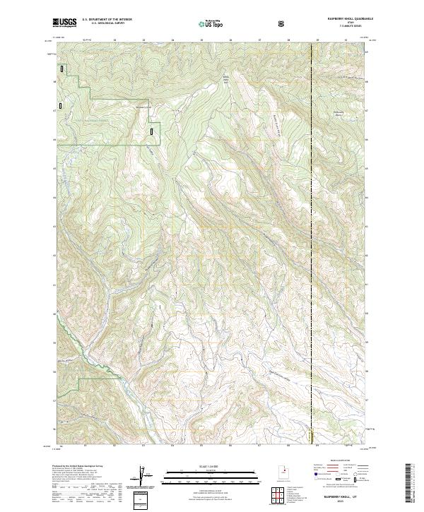
1962 Map of Raspberry Knoll
USGS Topo · Published 1975About this map
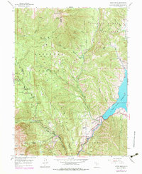
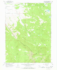
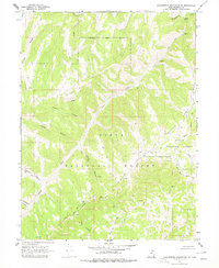
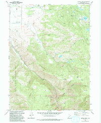
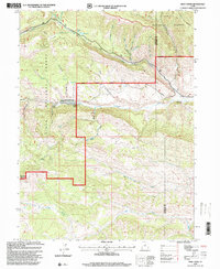
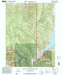
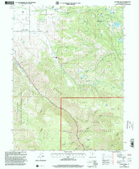
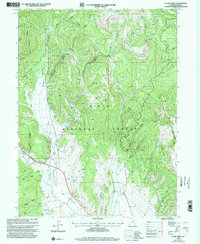
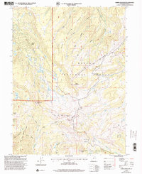
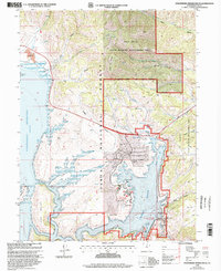
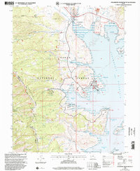
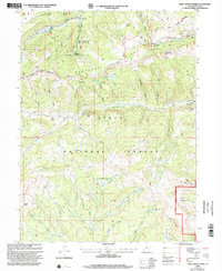
Ashley National Forest and Uinta National Forest meet along a high-elevation boundary that defines this stretch of the Western landscape. The topography is dominated by dramatic drainage systems, where Rough Hollow and Grass Hollow carve through the terrain toward the Duchesne and Wasatch county line. Notable for its historical administrative markers, the map shows the Old Indian Treaty Boundary cutting across the central ridges. Human activity is sparse but specific, indicated by a lone Oil Well in the northern reaches and a Mine near the northeastern corner. Water sources are critical here, with numerous Spring and Springs labels—such as Little Red Spring—marking vital points along the Jeep Trail network that connects Bobby Duke Pass to the McDonald Basin.
Find a feature on this map
26 named features on this map. Tap any name to fly to it.
Don’t see what you’re looking for? This feature index may not catch every label — zoom into the map to look around manually.
Map Details
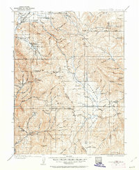
Editions of this 1962 Raspberry Knoll Map
2 editions found
Historical Maps of Wasatch County Through Time
73 maps found
1907 Strawberry Valley
Wasatch County, UT
1909 Strawberry Valley
Wasatch County, UT
1948 Aspen Grove
Wasatch County, UT

1950 Aspen Grove
Wasatch County, UT
1955 Heber City
Wasatch County, UT
1962 Deep Creek Canyon
Wasatch County, UT
1962 Raspberry Knoll
Wasatch County, UT
1962 Strawberry Peak
Wasatch County, UT
1962 Wolf Creek
Wasatch County, UT
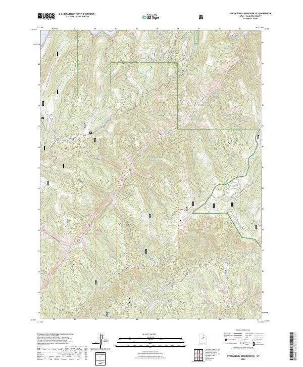
1966 Strawberry Reservoir NE
Wasatch County, UT
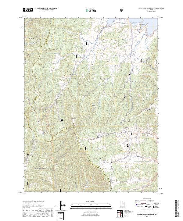
1966 Strawberry Reservoir NW
Wasatch County, UT
1966 Strawberry Reservoir SW
Wasatch County, UT
1967 Center Creek
Wasatch County, UT
1967 Co-Op Creek
Wasatch County, UT
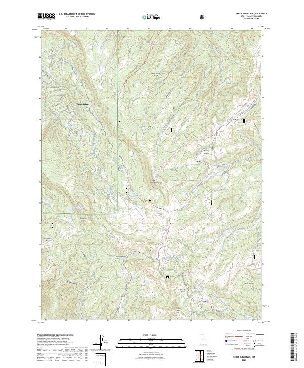
1967 Heber Mountain
Wasatch County, UT
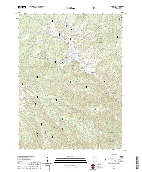
1967 Jimmies Point
Wasatch County, UT
1967 Strawberry Reservoir SE
Wasatch County, UT
1967 Twin Peaks
Wasatch County, UT
1967 Wolf Creek Summit
Wasatch County, UT
1969 Flat Ridge
Wasatch County, UT
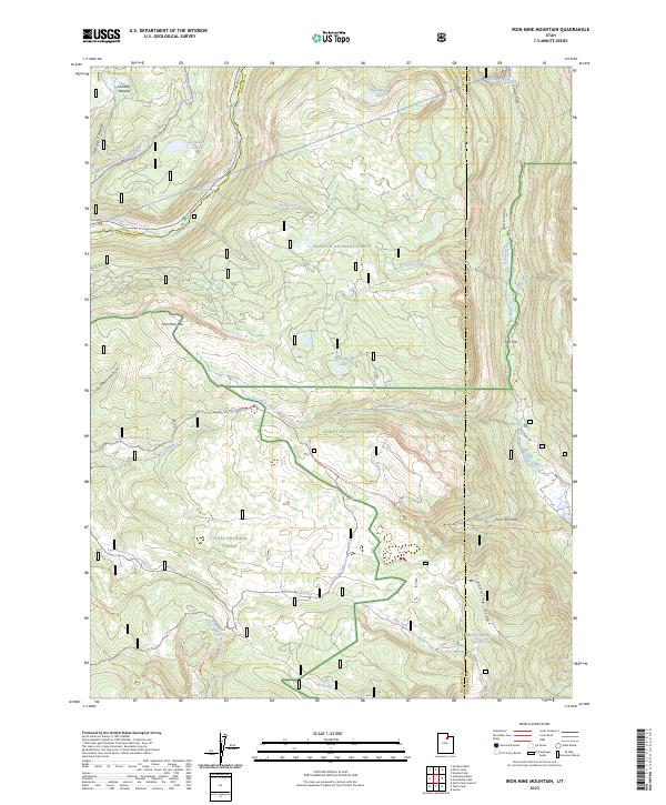
1972 Iron Mine Mountain
Wasatch County, UT
1972 Soapstone Basin
Wasatch County, UT
1978 Soldier Summit
Wasatch County, UT
1993 Aspen Grove
Wasatch County, UT
1993 Center Creek
Wasatch County, UT
1993 Co-Op Creek
Wasatch County, UT
1993 Heber Mountain
Wasatch County, UT
1993 Strawberry Reservoir SE
Wasatch County, UT
1993 Wolf Creek Summit
Wasatch County, UT
1994 Jimmies Point
Wasatch County, UT
1994 Strawberry Reservoir NE
Wasatch County, UT
1994 Strawberry Reservoir NW
Wasatch County, UT

1994 Strawberry Reservoir SW
Wasatch County, UT
1994 Twin Peaks
Wasatch County, UT
1996 Flat Ridge
Wasatch County, UT
1996 Iron Mine Mountain
Wasatch County, UT

1996 Strawberry Peak
Wasatch County, UT
1996 Strawberry Reservoir SE
Wasatch County, UT
1996 Wolf Creek
Wasatch County, UT
1998 Aspen Grove
Wasatch County, UT
1998 Center Creek
Wasatch County, UT
1998 Co-Op Creek
Wasatch County, UT
1998 Heber Mountain
Wasatch County, UT
1998 Jimmies Point
Wasatch County, UT
1998 Raspberry Knoll
Wasatch County, UT
1998 Soapstone Basin
Wasatch County, UT

1998 Soldier Summit
Wasatch County, UT
1998 Strawberry Reservoir NE
Wasatch County, UT
1998 Strawberry Reservoir NW
Wasatch County, UT
1998 Strawberry Reservoir SW
Wasatch County, UT
1998 Twin Peaks
Wasatch County, UT
1998 Wolf Creek Summit
Wasatch County, UT
1999 Heber City
Wasatch County, UT
2023 Aspen Grove
Wasatch County, UT
2023 Center Creek
Wasatch County, UT
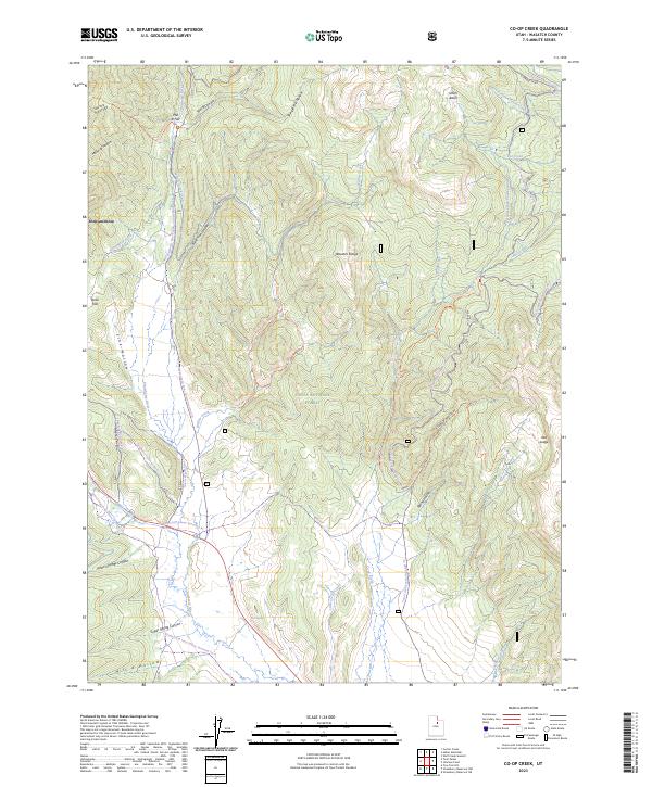
2023 Co-op Creek
Wasatch County, UT
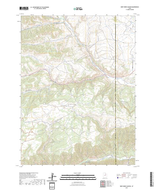
2023 Deep Creek Canyon
Wasatch County, UT
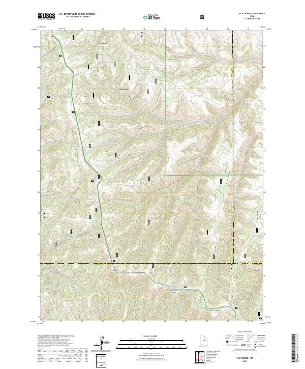
2023 Flat Ridge
Wasatch County, UT
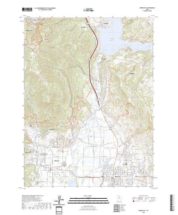
2023 Heber City
Wasatch County, UT
2023 Heber Mountain
Wasatch County, UT
2023 Iron Mine Mountain
Wasatch County, UT
2023 Jimmies Point
Wasatch County, UT
2023 Raspberry Knoll
Wasatch County, UT
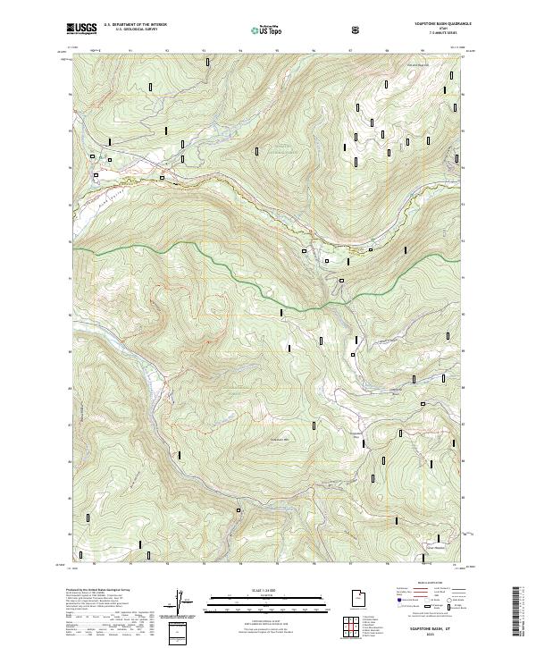
2023 Soapstone Basin
Wasatch County, UT
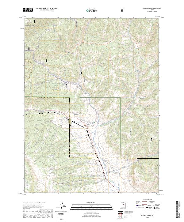
2023 Soldier Summit
Wasatch County, UT

2023 Strawberry Peak
Wasatch County, UT
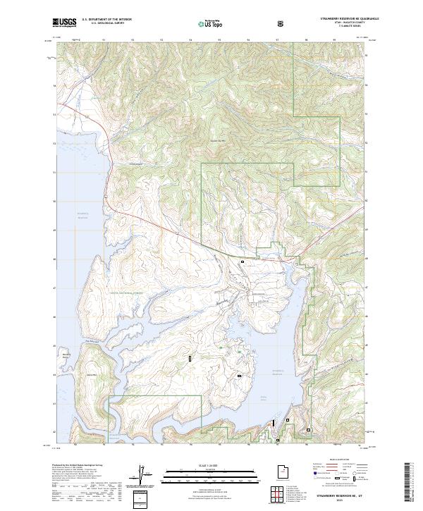
2023 Strawberry Reservoir NE
Wasatch County, UT
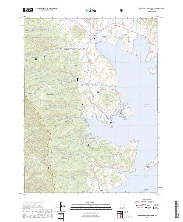
2023 Strawberry Reservoir NW
Wasatch County, UT
2023 Strawberry Reservoir SE
Wasatch County, UT
2023 Strawberry Reservoir SW
Wasatch County, UT

2023 Twin Peaks
Wasatch County, UT
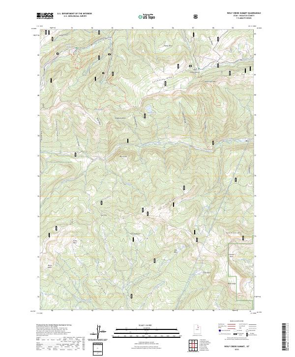
2023 Wolf Creek Summit
Wasatch County, UT
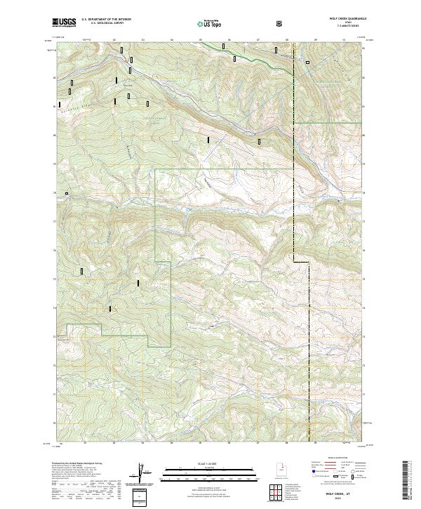
2023 Wolf Creek
Wasatch County, UT