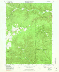
1969 Map of Rathbun
USGS Topo · Published 1981About this map
Penn Central tracks wind through the narrow valley of West Branch Penn Central Creek, connecting the small settlements of Rathbun, Swissmont, and Beechwood in this 1969 topographic survey. The landscape is defined by the steep hollows and ridges of the Elk State Forest and State Game Lands No 14, where namesake features like Schoolhouse Hollow and Friddle Hollow offer clues to the area's early rural development.
Find a feature on this map
52 named features on this map. Tap any name to fly to it.
Don’t see what you’re looking for? This feature index may not catch every label — zoom into the map to look around manually.
Map Details
Editions of this 1969 Rathbun Map
3 editions found
Other maps of this area

1935 · Mt. Jewett
USGS Topo · 1:48,000

1940 · Mt. Jewett
USGS Topo · 1:62,500

1941 · Benezette
USGS Topo · 1:62,500

1941 · Ridgway
USGS Topo · 1:62,500

1943 · Benezette
USGS Topo · 1:62,500

1944 · Ridgway
USGS Topo · 1:62,500

1948 · Crosby
USGS Topo · 1:62,500

1948 · Wildwood Fire Tower
USGS Topo · 1:24,000

1948 · Rich Valley
USGS Topo · 1:24,000
1950 · Rich Valley
USGS Topo · 1:24,000
Featured Places
- Saint Marys, PA
- Benezette Township, PA
- Shippen Township, PA
- Jay Township, PA
- Beechwood, Shippen Township