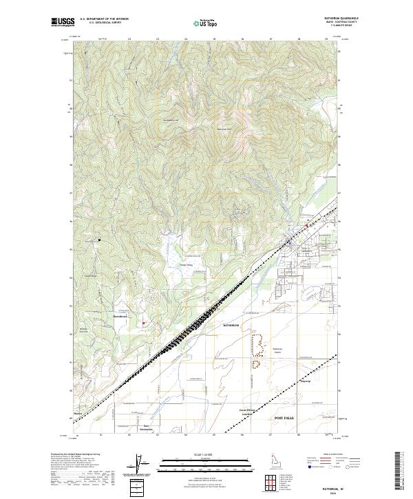
2024 Map of Rathdrum
USGS Topo · Published 2024About this map
Rathdrum anchors this portion of Kootenai County, where the southern slopes of Rathdrum Mtn meet the expanse of the Rathdrum Prairie. The landscape is defined by its water management and transition from high timbered ridges like Danby Ridge to the valley floor. The East Greenacres Main Ditch and East Greenacres North Ditch trace the historical development of irrigation that transformed this region's agriculture. Small settlements and residential pockets such as Howelltown, East Greenacres, and Hidden Valley are spread across the lowlands, while Mount Calvary Cem provides a point of genealogical interest. To the south, the map reaches the northern edge of Post Falls and includes Coeur d'Alene Junction, marking a critical nexus for regional transport and the local economy.
Find a feature on this map
68 named features on this map. Tap any name to fly to it.
Don’t see what you’re looking for? This feature index may not catch every label — zoom into the map to look around manually.
Map Details
Editions of this 2024 Rathdrum Map
This is the sole edition of this map. No revisions or reprints were ever made.
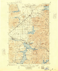
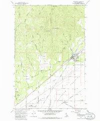
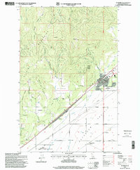
Historical Maps of Post Falls Through Time
4 maps found