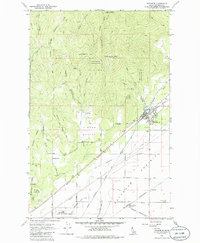
1961 Map of Rathdrum
USGS Topo · Published 1986About this map
Rathdrum serves as the focal point of this northern Idaho landscape, where the flat agricultural expanse of Rathdrum Prairie meets the rising slopes of the Coeur d'Alene National Forest. During the early 1960s, the town functioned as a critical rail hub, evidenced by the convergence of the Northern Pacific, the Chicago Milwaukee St Paul and Pacific, and the Spokane International railroads. To the north, the terrain becomes increasingly complex as it climbs toward Rathdrum Mtn, cut by drainages like Swansons Chute and Youngs Draw. Smaller residential clusters and landmarks such as Howelltown, East Greenacres, and the Grange Hall provide valuable data for genealogists tracing local families. The map also documents the mid-century infrastructure of the region, including a major pipeline and the distinct layout of Hidden Valley.
Find a feature on this map
48 named features on this map. Tap any name to fly to it.
Don’t see what you’re looking for? This feature index may not catch every label — zoom into the map to look around manually.
Map Details
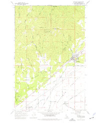
Editions of this 1961 Rathdrum Map

Other maps of this area

1901 · Spokane
USGS Topo · 1:125,000

1903 · Rathdrum
USGS Topo · 1:125,000

1943 · Mt Spokane
USGS Topo · 1:62,500

1949 · Greenacres
USGS Topo · 1:62,500

1950 · Mt Spokane
USGS Topo · 1:62,500

1951 · Greenacres
USGS Topo · 1:62,500

1955 · Spokane
USGS Topo · 1:250,000

1957 · Coeur D'Alene
USGS Topo · 1:62,500

1958 · Spokane
USGS Topo · 1:250,000

1961 · Hayden
USGS Topo · 1:24,000