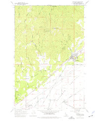
1961 Map of Rathdrum
USGS Topo · Published 1977About this map
Rathdrum serves as the focal point of this 1961 survey, situated at the base of the timbered Rathdrum Mtn. The landscape is sharply divided between the mountainous terrain of the Coeur d'Alene National Forest to the north and the expansive agricultural flats of Rathdrum Prairie to the south. This transition zone was a vital transportation corridor, evidenced by the convergence of the Northern Pacific and the Chicago Milwaukee St Paul and Pacific railroads near Coeur d'Alene Junction.
Find a feature on this map
51 named features on this map. Tap any name to fly to it.
Don’t see what you’re looking for? This feature index may not catch every label — zoom into the map to look around manually.
Map Details
Editions of this 1961 Rathdrum Map

Other maps of this area

1901 · Spokane
USGS Topo · 1:125,000

1903 · Rathdrum
USGS Topo · 1:125,000

1943 · Mt Spokane
USGS Topo · 1:62,500

1949 · Greenacres
USGS Topo · 1:62,500

1950 · Mt Spokane
USGS Topo · 1:62,500

1951 · Greenacres
USGS Topo · 1:62,500

1955 · Spokane
USGS Topo · 1:250,000

1957 · Coeur D'Alene
USGS Topo · 1:62,500

1958 · Spokane
USGS Topo · 1:250,000

1961 · Hayden
USGS Topo · 1:24,000