
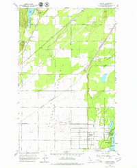
1961 Map of Hayden
USGS Topo · Published 1962About this map
Rathdrum Prairie dominates the central landscape of this Kootenai County survey, illustrating the area's development during the early 1960s. The region is a hub of transportation and logistics, marked by the extensive Coeur d'Alene Air Terminal and a dense network of competing rail lines including the Chicago Milwaukee St Paul and Pacific, the Spokane International, and the Northern Pacific.
Find a feature on this map
44 named features on this map. Tap any name to fly to it.
Don’t see what you’re looking for? This feature index may not catch every label — zoom into the map to look around manually.
Map Details
Editions of this 1961 Hayden Map
2 editions found
Other maps of this area

1903 · Rathdrum
USGS Topo · 1:125,000

1955 · Spokane
USGS Topo · 1:250,000

1957 · Coeur D'Alene
USGS Topo · 1:62,500

1957 · Lane
USGS Topo · 1:62,500

1958 · Spokane
USGS Topo · 1:250,000

1961 · Rathdrum
USGS Topo · 1:24,000

1961 · Spirit Lake East
USGS Topo · 1:24,000

1961 · Athol
USGS Topo · 1:24,000
1961 · Spirit Lake West
USGS Topo · 1:24,000

1961 · Spirit Lake
USGS Topo · 1:62,500