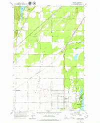
1961 Map of Hayden
USGS Topo · Published 1979About this map
Rathdrum Prairie anchors the landscape of northern Idaho in this early 1960s survey, showing a transition from the agricultural expanse toward the recreation-focused shorelines of Hayden Lake. The area's mid-century aviation and transit infrastructure is prominent, featuring the Coeur d'Alene Air Terminal and a dense network of railroads including the Spokane International and the Chicago Milwaukee St Paul and Pacific.
Find a feature on this map
38 named features on this map. Tap any name to fly to it.
Don’t see what you’re looking for? This feature index may not catch every label — zoom into the map to look around manually.
Map Details
Editions of this 1961 Hayden Map
2 editions found
Other maps of this area

1903 · Rathdrum
USGS Topo · 1:125,000

1955 · Spokane
USGS Topo · 1:250,000

1957 · Coeur D'Alene
USGS Topo · 1:62,500

1957 · Lane
USGS Topo · 1:62,500

1958 · Spokane
USGS Topo · 1:250,000

1961 · Hayden
USGS Topo · 1:24,000

1961 · Rathdrum
USGS Topo · 1:24,000

1961 · Spirit Lake East
USGS Topo · 1:24,000

1961 · Athol
USGS Topo · 1:24,000
1961 · Spirit Lake West
USGS Topo · 1:24,000