
1961 Map of Athol
USGS Topo · Published 1962About this map
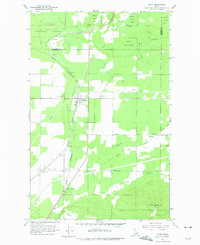
Athol stands at the center of this 1961 survey, serving as a critical rail nexus where the Spokane International and Northern Pacific railroads converge. The landscape is defined by the broad, flat expanse of Eightmile Prairie to the west and the rising slopes of Cedar Mountain to the southeast. Local history is anchored by sites like Mountain View Cem and the Cedar Mountain Sch, which reflect the community's early mid-century development.
Find a feature on this map
20 named features on this map. Tap any name to fly to it.
Don’t see what you’re looking for? This feature index may not catch every label — zoom into the map to look around manually.
Map Details
Editions of this 1961 Athol Map
2 editions found
Other maps of this area

1901 · Sandpoint
USGS Topo · 1:125,000

1903 · Rathdrum
USGS Topo · 1:125,000

1911 · Priest Lake
USGS Topo · 1:250,000

1911 · Sandpoint
USGS Topo · 1:125,000

1913 · Priest Lake
USGS Topo · 1:250,000

1955 · Spokane
USGS Topo · 1:250,000

1958 · Spokane
USGS Topo · 1:250,000

1958 · Sandpoint
USGS Topo · 1:250,000

1961 · Hayden
USGS Topo · 1:24,000

1961 · Bayview
USGS Topo · 1:24,000