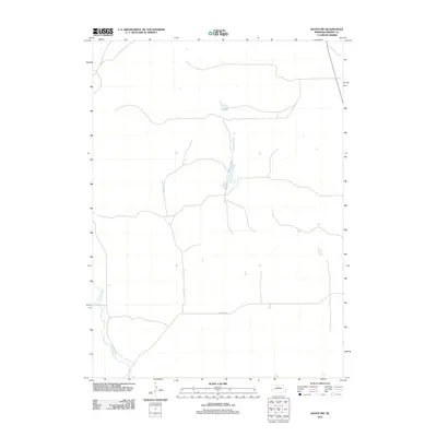
2011 Map of Raven SW
USGS Topo · Published 2011About this map
Calamus River meanders through the southwestern corner of this Sandhills landscape, creating a distinct riparian corridor amidst a sparse network of section roads. This 2011 survey illustrates the rural character of Brown County, where the terrain is defined by undulating landforms and small, scattered basins that occasionally hold water. The primary thoroughfare, Elsmere Rd, provides one of the few established east-west routes across this portion of the Nebraska plains, reflecting the low-density settlement patterns typical of the region. This document serves as a precise record of the natural drainage and minimal infrastructure in a remote agricultural and ranching environment at the start of the decade.
Find a feature on this map
2 named features on this map. Tap any name to fly to it.
Don’t see what you’re looking for? This feature index may not catch every label — zoom into the map to look around manually.
Map Details
Editions of this 2011 Raven SW Map
This is the sole edition of this map. No revisions or reprints were ever made.
Other maps of this area

1949 · Koshopah
USGS Topo · 1:62,500

1951 · Moon Lake
USGS Topo · 1:62,500

1951 · Koshopah
USGS Topo · 1:62,500

1955 · O'Neill
USGS Topo · 1:250,000

1957 · Valentine
USGS Topo · 1:250,000

1959 · Valentine
USGS Topo · 1:250,000

1959 · O'Neill
USGS Topo · 1:250,000

1969 · O'Neill
USGS Topo · 1:250,000

1982 · Lost Lake Ranch
USGS Topo · 1:24,000

1982 · Hofeld Lake
USGS Topo · 1:24,000